Plan Guyana as three different driving environments
Guyana is not one uniform road trip. Georgetown is a low-lying urban grid where parking, drainage and bridge timing shape the day. The coastal and Demerara approaches combine settlements, construction and traffic controls. Beyond Linden, the road decision becomes more dependent on current works, weather, fuel, daylight, communications and local knowledge. The page therefore separates published rules from route advice and uses 2026-08-18 as its review date.
The first decision is whether driving improves the itinerary. A car can be useful for a planned coastal stage, but a Georgetown visit can become easier when the vehicle is parked at a confirmed location. The Linden-Lethem corridor is a different undertaking again: government upgrades are in progress, historical weather disruption has closed sections, and Iwokrama recommends land or air access to its forest lodge. Confirm the route, vehicle and support plan before booking a long stage.

Licence, IDP and rental contract boundaries
The Guyana Revenue Authority foreign-licence guidance says a non-resident visitor with a valid foreign driver licence may drive for 60 days after entry. The driver must have the licence issued by the competent authority in the country of residence and documents such as a passport showing the date of entry. After 60 days, the visitor must apply for a Foreign Driver’s Permit. If the licence is not in English, the GRA requires a translation from the relevant embassy or an international language institute for that permit process.
That is the national document boundary, not a rental guarantee. The GRA driver-licence guidance says a person under 17 must not drive a motor vehicle other than a motorcycle or invalid carriage, but an operator may set a higher rental age or require licence history, a deposit, a card, an IDP or an approved vehicle class. The GRA IDP page is primarily about permits issued to holders of Guyanese licences for travel abroad. Do not interpret it as a requirement for every foreign visitor driving inside Guyana.
Before payment, ask the rental branch to confirm in writing:
- named drivers, age and licence history;
- the original licence, passport and entry evidence it will accept;
- whether a non-English licence needs an embassy translation or IDP;
- permitted road surfaces, the Linden-Lethem corridor and any 4WD or guide condition;
- insurance territory, excess, recovery limits and border permissions;
- fuel policy, deposit release and the roadside number.
Photograph the vehicle plate, registration, damage record, tyres, lights and contract. A valid licence allows a legal driving decision; it does not make a city rental suitable for a remote route.
Left-side traffic, speed signs and parking decisions
The Motor Vehicles and Road Traffic Act states the rule of the road: keep to the left or near side when meeting or being overtaken, and overtake on the right or offside unless there is a sufficient reason to deviate. It also gives authorities power to restrict roads and direct traffic. Use the local sign, police direction and temporary work-zone control as the immediate rule.
The structured speed fields on this page intentionally avoid guessed national numbers. A sign, work-zone restriction, bridge control, surface condition, rain shower or pedestrian crossing can make the safe speed lower than a remembered limit. Brake before a bend, leave space behind heavy traffic and do not pass when the view, shoulder or escape route is uncertain.
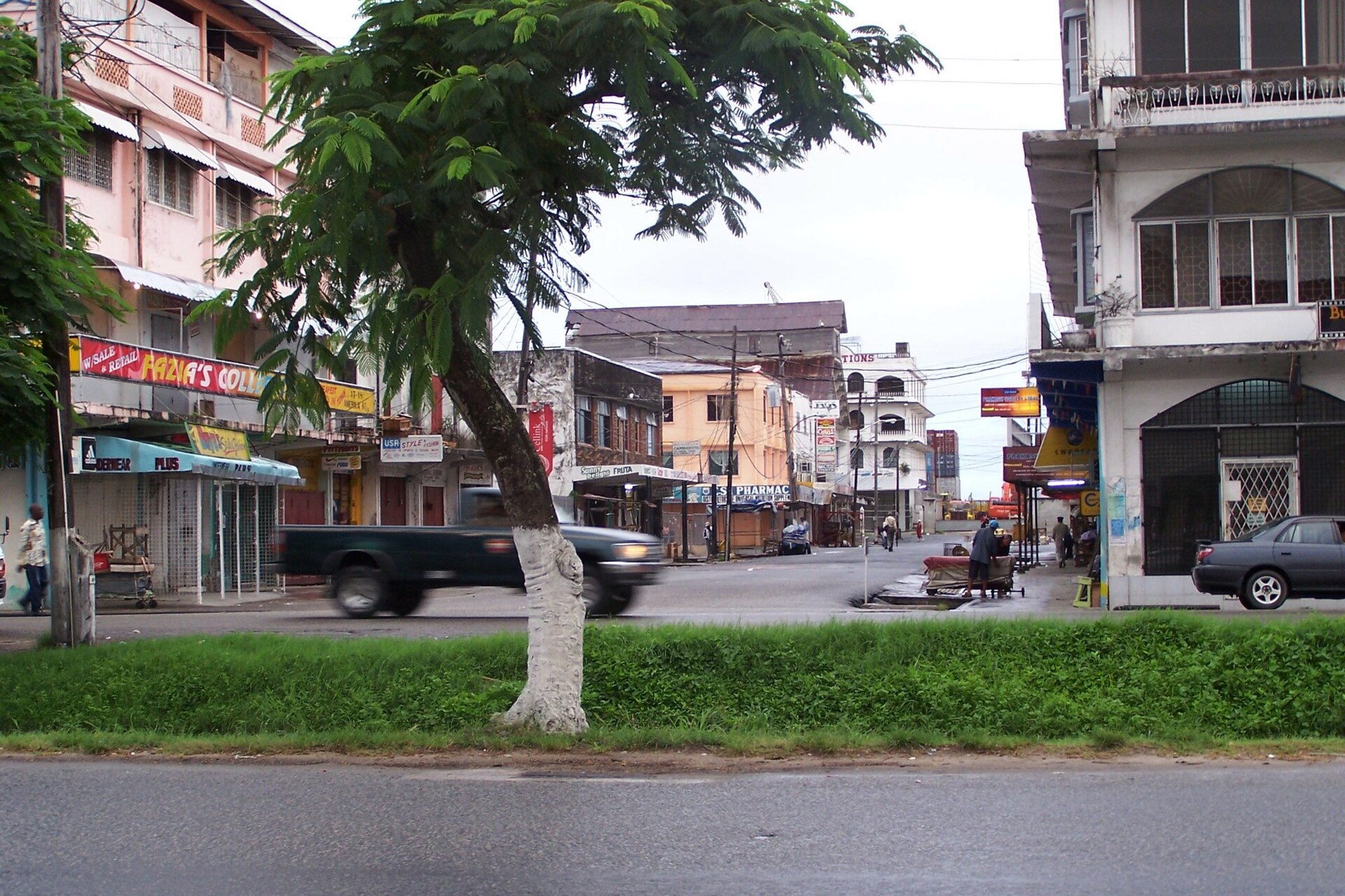
In Georgetown, save a legal parking or hotel location before the final turn. Do not block a drain, driveway, junction, bridge approach, bus stop or narrow lane. If the central visit is walkable, leave the vehicle parked and avoid adding a low-value circulation loop to a wet or congested street.
Georgetown drainage, rain and low-lying streets
Guyana’s Hydrometeorological Service publishes forecasts, rainfall information, tides, radar and warnings. Its flood-warning template says heavy rain or storm surge may cause flooding in low-lying areas, advises residents to avoid low areas and specifically tells drivers not to drive into water covering a roadway. Those instructions are more useful than a generic claim that a particular street is always passable.
Use the forecast and tide information as a route gate. Ask the hotel or local operator which approach is currently open, keep the vehicle away from standing water when an alternative exists, and turn around before water reaches the wheel hubs or hides the road edge. Do not follow another vehicle into unknown-depth water, and never stop in the lane to photograph a flood.
Demerara Harbour Bridge: schedule it as a dependency
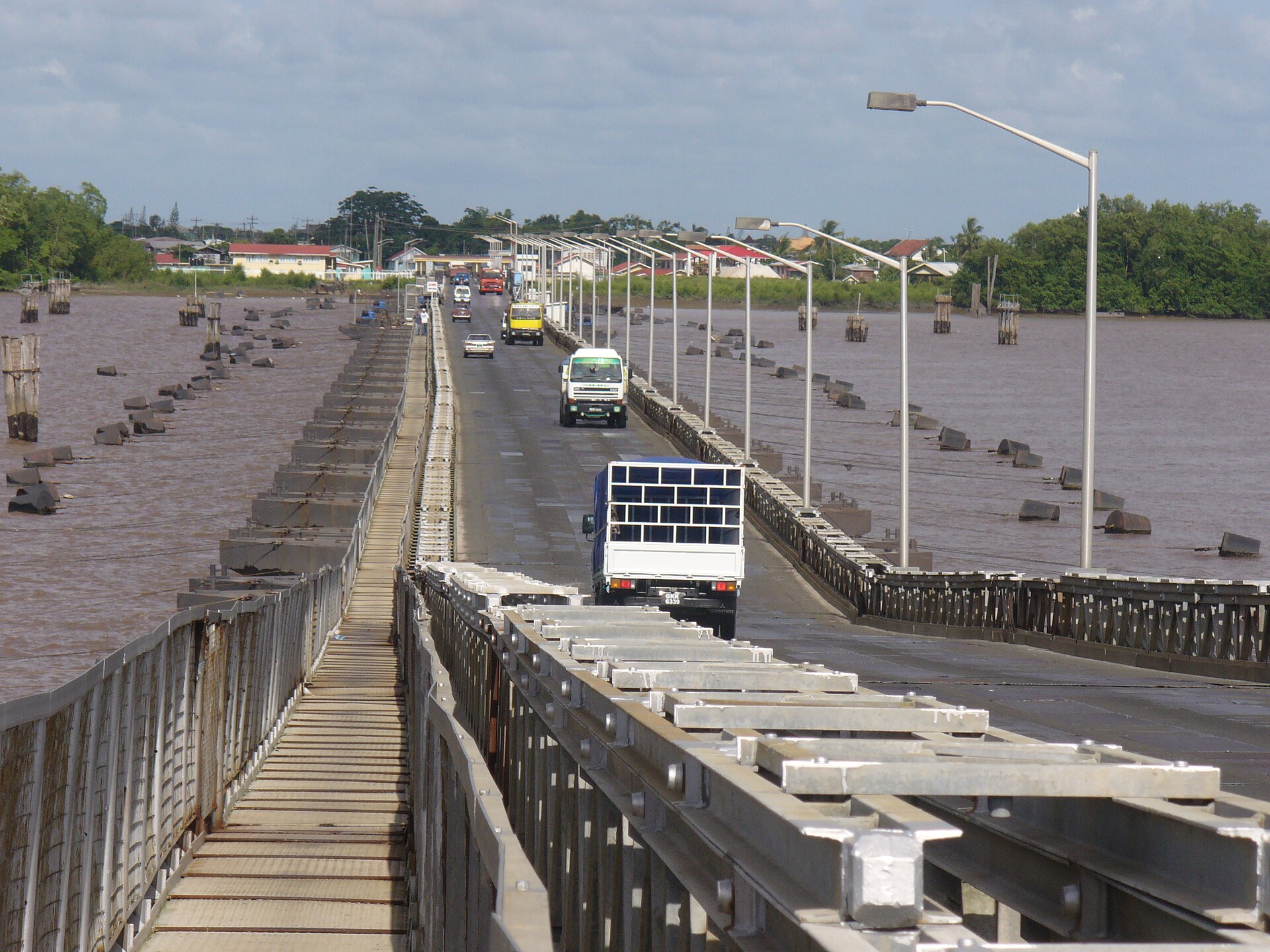
The Demerara Harbour Bridge authority publishes traffic alerts, scheduled closures, marine retraction procedures, heavy-vehicle crossing windows and current contact details. The Ministry of Agriculture bridge-schedule page points travellers to the official bridge website for closure information. Check the authority page immediately before a crossing and again if the weather or marine schedule changes.
Build a bridge buffer into any Georgetown, East Bank or West Bank transfer. A map ETA cannot account for a scheduled retraction, a maintenance closure, a queue or a traffic-control measure. Keep a backup night in the plan when an onward flight, lodge check-in or remote road stage depends on one crossing.

Soesdyke-Linden, Linden-Lethem and the Rupununi
The current Ministry of Public Works advisory describes reconstruction of the 73 km Soesdyke-Linden Highway. It warns of periodic lane closures, reduced speed limits, detour signs, temporary restrictions and possible delays. Follow the flag person and the current sign; a saved route map cannot override a work-zone instruction.
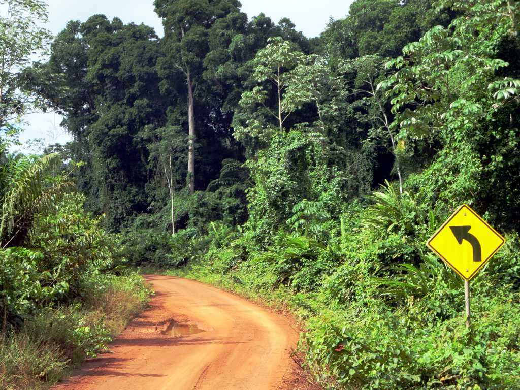
The government update on the Linden-Lethem project describes the transformation of about 450 km of dirt road into an all-weather route, with the work delivered in phases. That is project information, not a statement that every section is finished or suitable for a self-drive rental. A separate Ministry of Public Works incident statement recorded a heavy-rain washout in the Kurupukari-Lethem corridor that rendered a section impassable and affected Georgetown to Annai and Lethem traffic.
.jpg)
For a Rupununi or Iwokrama stage, ask the lodge, guide or local transport operator about the actual access route, surface, river or bridge condition, arrival window, fuel and communication plan. Iwokrama’s sustainable-tourism information describes land or air access, rainforest, wetlands and savannahs, and local Indigenous guides. That context matters: a forest destination is not automatically a road destination, and a guide’s access arrangement can be safer than a self-drive experiment.
Fuel, communications and remote resupply
The official sources reviewed here do not provide a nationwide guarantee for station opening hours, fuel stock, card acceptance or roadside recovery. Treat every remote fuel stop as a confirmed operational dependency. Fill before leaving a major settlement, ask when the next reliable supply point is open, keep a payment fallback and check the rental vehicle’s fuel type.
Download an offline map, save the rental branch and accommodation contacts, and tell the lodge or guide your planned departure and arrival window. Keep a reserve that matches the vehicle and route rather than a generic distance rule. If the road status changes, turn back while a known fuel and communication option remains available.
Emergency, police and breakdown decisions
The Guyana Police Force lists 911 for emergencies or crimes in progress, +592 225-6411 for non-emergencies and +592 227-2349 for Traffic Headquarters. The Civil Defence Commission publishes 24/7 disaster-response contacts: +592 623-1700, +592 226-1027, +592 678-9989 and +592 600-7500. Save these numbers before leaving coverage; use the contact appropriate to the incident described by the authority.
After a crash or breakdown, switch on hazard lights, move away from the live lane only if safe, keep passengers away from water and traffic, and report the road name, direction, nearest settlement or landmark, plate, injuries and hazards. Call 911 for an immediate police emergency, then use the rental contract’s roadside service. Do not authorize an unknown repair or walk into an isolated stretch without the operator’s instructions.
Wildlife and livestock change the stopping problem. Slow early, keep distance, do not corner an animal and do not stop on a blind bend. Iwokrama’s work includes monitoring road use and wildlife presence, so the forest road is a shared habitat, not a normal urban lane. Follow local guides and community instructions around protected or Indigenous areas.
Guyana departure checklist
- Confirm the original licence, passport entry date, translation or IDP decision and rental contract.
- Record the named drivers, plate, registration, insurance territory, excess and roadside contact.
- Check the Hydromet forecast, radar, tide and flood advisories for the exact route.
- Check the Demerara Harbour Bridge alerts and the Soesdyke-Linden work notice.
- Confirm the Linden-Lethem or Rupununi access plan with the local operator, including surface, fuel, daylight and recovery.
- Fill before a remote section, carry a payment fallback and save offline contacts.
- Keep remote transfers in daylight, slow for people and animals, and never enter water covering the road.
- Save 911, police non-emergency, Traffic Headquarters and the CDC disaster-response numbers.
Official sources and review boundary
The driving facts and operational links above were reviewed on 18 August 2026. Laws, bridge schedules, construction notices, water levels, weather warnings, fuel availability, rental policies and access permissions can change. Re-open the relevant authority page and ask the local operator on the day of travel. The current road sign, police direction, bridge authority and written rental contract control.
- Motor Vehicles and Road Traffic Act, Guyana
- Guyana Revenue Authority: driving with a foreign licence
- Guyana Revenue Authority: driver licence application guidance
- Guyana Revenue Authority: International Driver’s Permit
- Guyana Police Force: emergency and traffic contacts
- Demerara Harbour Bridge authority and bridge schedule directory
- Ministry of Public Works: Soesdyke-Linden advisory
- Department of Public Information: Linden-Lethem upgrade
- Department of Public Information: Kurupukari-Lethem road incident
- Hydrometeorological Service of Guyana and flood-warning template
- Civil Defence Commission
- Iwokrama: sustainable tourism and access context
- Wikimedia Commons: Georgetown street photograph and public-domain statement
- Wikimedia Commons: Demerara Harbour Bridge photograph and public-domain statement
- Wikimedia Commons: Linden-Lethem Road photograph and CC BY 2.0
Continue planning
Use the route weather and closure planner, roadside incident recovery planner, driving time planner, fuel cost calculator and emergency numbers tool to record the answers, contacts and decision points. These tools organize evidence; the current authority notice, road sign, local operator and written rental contract remain controlling.
Frequently Asked Questions
- Which side of the road do people drive on in Guyana?
- Guyana drives on the left. The Motor Vehicles and Road Traffic Act says a driver should keep to the left or near side when meeting or being overtaken, and overtake on the right or offside unless there is a sufficient reason to deviate. Build the left-side routine before leaving the rental counter.
- Can a visitor drive in Guyana with a foreign licence?
- A non-resident visitor with a valid foreign driver licence may drive on Guyana's roads after entry under the 2022 foreign-licence regulations. Carry the original licence and passport or other entry evidence, then confirm the rental company's own document list before payment.
- How long can I use my foreign licence in Guyana?
- The Guyana Revenue Authority says the visitor permission lasts 60 days after entry. After that period, the driver must apply for a Foreign Driver's Permit to continue driving. Keep the entry date accessible because the legal period and the rental contract are separate checks.
- Do I need an International Driving Permit for Guyana?
- The page is marked no for a blanket requirement because the GRA rule accepts a valid foreign licence for the first 60 days. An IDP or translation may still be requested by a rental operator, insurer or the authority for a licence that cannot be read in English. Confirm the exact requirement in writing.
- What if my licence is not in English?
- The GRA says a foreign licence that is not in English needs a translation from the relevant embassy or an international language institute when applying for the Foreign Driver's Permit. Ask the rental branch what it will accept before travel and carry the original document with the translation.
- What is the legal minimum driving age in Guyana?
- The GRA's licence guidance says a person under 17 must not drive a motor vehicle other than a motorcycle or invalid carriage on the road. This legal boundary does not promise rental approval at 17, because hire-car terms and vehicle classes can impose a higher age.
- How old must I be to rent a car in Guyana?
- Do not infer a national rental age from the driver-licence rule. Ask the selected operator for the named-driver age, licence-history, deposit, insurance and vehicle-class conditions, and keep the written answer with the reservation. A local hire-car licence requirement is not the same as a visitor rental contract.
- What documents should I show at a Guyana rental desk?
- Start with the original valid foreign licence, passport showing entry, payment card and reservation. Ask whether the branch also requires an IDP or translation, proof of return travel, a deposit method, an additional-driver record or a particular insurance document. Photograph the contract, plate and roadside number before moving.
- Can a normal rental car use the Linden-Lethem corridor?
- Never assume that a normal city rental is approved for the interior route. Ask for written permission covering the route surface, distance, insurance territory, recovery plan and any 4WD or guide requirement. The road is subject to works, weather disruption and remote service gaps, so an operator's approval must be specific.
- What should I expect when driving in Georgetown?
- Plan Georgetown block by block. Confirm a legal car park or hotel space before entering a busy central street, keep the left-side position through turns, and leave a margin for pedestrians, bicycles, buses and standing water. A short map distance does not guarantee an easy parking or exit decision.
- How should I plan around Georgetown drainage and flooding?
- Hydromet's flood-warning template tells drivers not to enter a road covered by water and warns that low-lying and poor-drainage areas can flood. Use the current forecast, tide and local advisory, then choose a higher or less exposed route. Never use the height of another vehicle's wake as proof that water is safe.
- How do I check the Demerara Harbour Bridge before crossing?
- Use the official Demerara Harbour Bridge website for traffic alerts, scheduled closures, marine retraction information and current crossing conditions. Add a bridge buffer to a Georgetown transfer and keep a route that does not depend on arriving during a narrow opening or traffic window.
- What is happening on the Soesdyke-Linden Highway?
- The Ministry of Public Works advisory describes reconstruction of the 73 km Soesdyke-Linden Highway, including lane closures, reduced speeds and possible delays. Follow flag personnel, temporary signs and the live advisory rather than treating the road as an unchanged transfer corridor.
- Can I drive from Linden to Lethem in one day?
- Do not schedule the corridor from a map estimate alone. The government describes a major upgrade project and has recorded weather-related washouts that affected Georgetown to Annai and Lethem traffic. Confirm the current status, fuel, daylight, accommodation, communications and vehicle recovery plan before committing to a stage.
- Is the Linden-Lethem Road paved all the way?
- No current all-weather guarantee should be inferred. The 2025 government project update describes the transformation of about 450 km of dirt road and says the work is being delivered in phases. Treat the route as a project and status question, not as a standard paved tourist highway.
- How should I approach Iwokrama and the Rupununi?
- Iwokrama describes travel by land or air to its River Lodge and presents the North Rupununi as a rainforest, wetland and savannah landscape. Coordinate with the lodge or local guide about the actual access mode, road condition, arrival time, permissions and weather. Do not substitute a general map pin for local operational confirmation.
- When is the risky weather window for a Guyana road trip?
- Use the current Hydromet forecast and warnings rather than one national rainy-season label. Heavy rain can saturate soil, raise water levels and reduce visibility, while high tide can worsen low-lying or riverine flooding. A remote departure should move when the forecast removes the safety margin.
- Where can I check Guyana road and weather alerts?
- Check Hydromet for forecasts, radar, tides and warnings, the Civil Defence Commission for disaster advisories, and the Ministry of Public Works or bridge authority for route-specific notices. Recheck after the last heavy shower instead of relying on the night-before check. Keep screenshots or offline notes when leaving reliable coverage.
- Where should I refuel before a remote drive?
- Treat fuel as a confirmed-stop question. Fill before leaving a major settlement, ask the rental branch or local operator about the next usable station, and carry a reserve that matches the vehicle and route. Do not infer opening hours, card acceptance or stock from a map listing.
- Can I rely on card payment or a fuel station in the interior?
- No nationwide card, opening-hour or stock guarantee is stated here. Carry a payment fallback, confirm the fuel type, and ask the local operator about the next reliable resupply point. A route that is open for traffic can still have no convenient service at the time you arrive.
- Should I drive at night in Guyana?
- Keep Georgetown and remote transfers in daylight when possible. Darkness reduces the time to see pedestrians, animals, unmarked edges, road works, standing water and stopped vehicles, and it leaves less recovery time after a bridge or weather delay. If a night leg cannot move, shorten it and confirm the destination's arrival procedure first.
- How should I respond to wildlife or livestock near the road?
- Slow down early, stay in your lane and do not chase, sound at or pass an animal when the escape path is unclear. Iwokrama's conservation work documents wildlife presence and road-use monitoring in the forest. Stop only in a safe place, keep distance and follow a guide's instructions in protected or community areas.
- What emergency number should I call after a crash?
- The Guyana Police Force lists 911 for emergencies or crimes in progress. Give the road or bridge name, direction, nearest settlement or landmark, vehicle plate, injuries and water or traffic hazards. Move people away from live traffic only when it is safe, then call the rental roadside service as a separate contract step.
- What disaster-response numbers does Guyana publish?
- The Civil Defence Commission publishes a 24/7 emergency hotline list: +592 623-1700, +592 226-1027, +592 678-9989 and +592 600-7500. Use 911 for a police emergency or crime in progress, and use the CDC contacts for disaster-response coordination when the published advisory directs you there.
- What should I do if the rental car breaks down?
- Switch on hazard lights, leave the live lane only if it is safe, keep passengers away from traffic and call 911 for danger or injury. Then call the rental contract's roadside line, record the location and wait for written repair or recovery instructions. Do not walk into a flooded or isolated section to find help.
- Can I cross into Brazil with a Guyana rental car?
- Do not treat a border crossing as included in a domestic rental. Obtain written permission from the operator, confirm insurance territory, customs and immigration documents, recovery support and the approved vehicle route. If the contract does not state the permission clearly, keep the car within the approved Guyana itinerary.
Information Sources & Disclaimer
This guide compiles information from the official transport authorities, road operators, government travel information, and automobile associations linked for Guyana.
While we strive to keep this information as accurate and up-to-date as possible (last reviewed: August 2026), traffic laws and toll rates can change without notice. We recommend verifying critical information with the local authorities or your car rental agency upon arrival.
Learn more about our Editorial Process →Compare Your Origin and Destination
Use the comparison tool to check driving side, units, documents, and other destination data for your route.